
Mapping Grassland Productivity with NASA
Mapping Grassland Productivity on South Central Oklahoma and Texas Ranch Lands to Evaluate Management and Quantify Soil Carbon Fluxes
Oklahoma & Texas Agriculture – Colorado Node
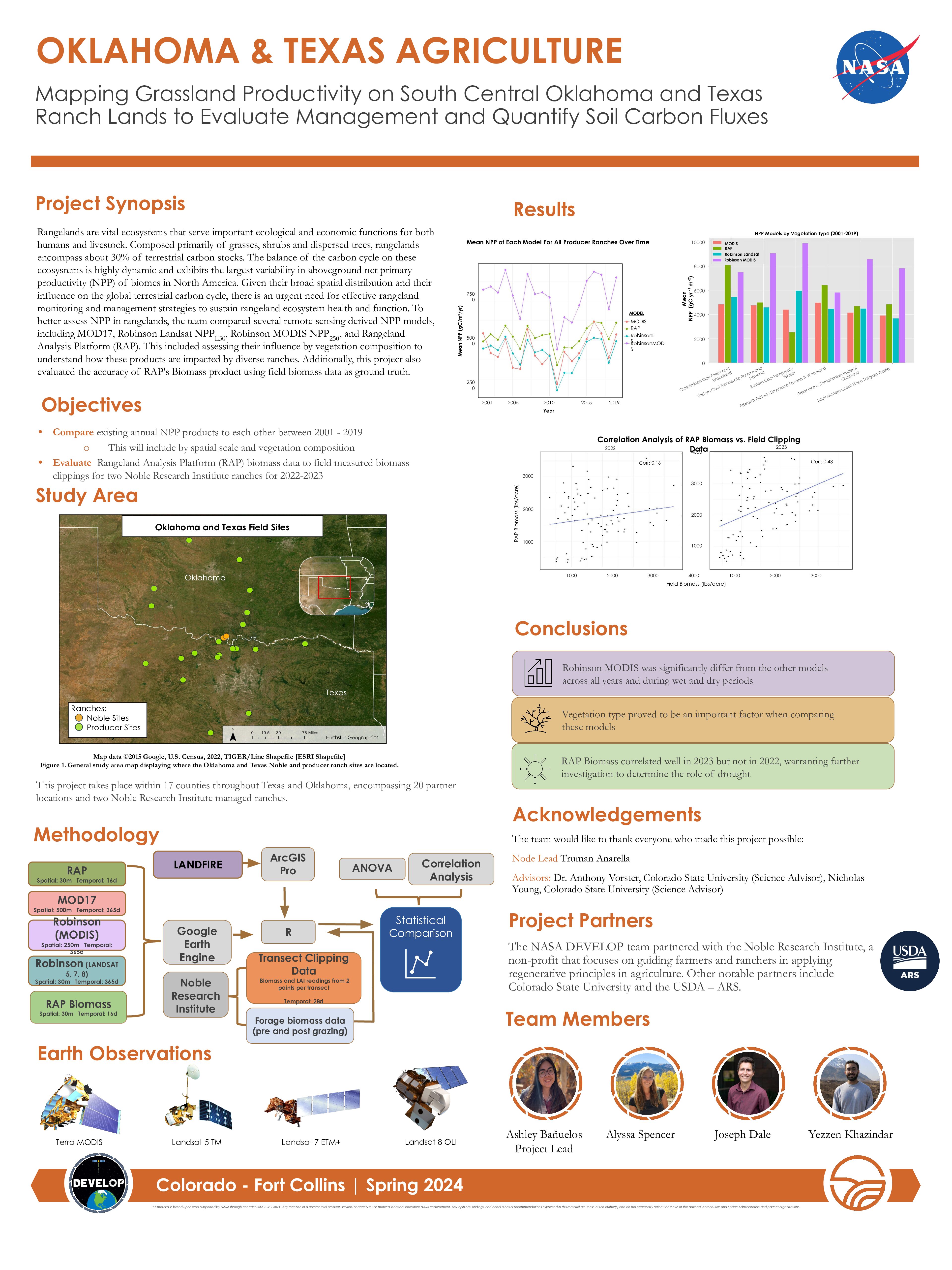
This project focused on leveraging satellite data and geospatial technologies to address real-world environmental challenges. To view more information, you can read the technical paper here, and view the poster below.
